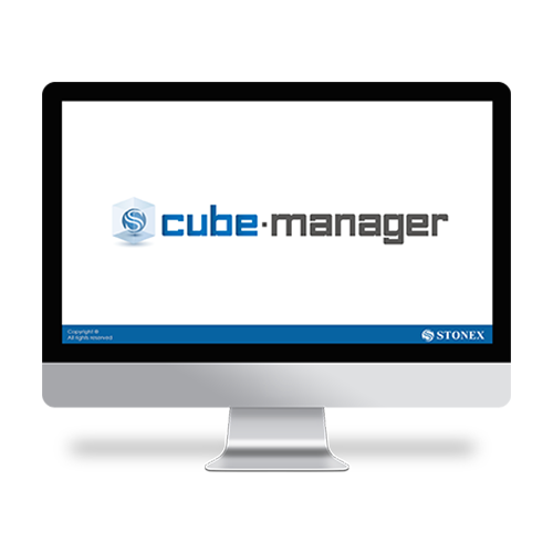
Cube-manager
Cube-manager has been developed to work on desktop computers running Microsoft Windows and it implements the tools to download, to manage and to process the data acquired with one of the mobile solutions.
Using this software, you can integrate mixed GNSS RTK and Total Station data, process Raw GNSS data in different ways, import and export the data from and to the most popular known formats.
This software will help operators providing the best functions for data transferring, graphical visualization and analytical data processing.
The software is composed of various optional modules and a free version (Cube-link).
Cube-manager is a software for managing data from GNSS
receivers and Total Stations, it is composed of 3 main modules (P, T, M), each one specialized in a series of functions. Among the functions shared by all the modules, you can have plano-altimetric elaborations, generate 3D models and calculate contour lines.
The measurements can be displayed in 2D, 3D and superimposed on raster, satellite or cadastral images. Through a sophisticated internal CAD, you can interact with the data using powerful and complete drawing tools and snap functions, even in 3D. Importing and exporting data are supported in various formats such as DXF, DWG, KML, CSV and others.
-
-
Software Office Solutions
Entirely designed and developed by the Stonex R & D department, Ntrip-caster is the ideal software for GNSS NTRIP network management.DESCRIPTION
It’s perfect integration with the SC200 makes Ntrip-caster the essential tool for everyday’s work. Ntrip-caster gives the user an intuitive and powerful interface. It is an excellent server program to manage CORS stations in an autonomous and independent way; to transmit a single-base correction to multiple rover users, to manage them simultaneously and at any time in a reliable and efficient way.
Ntrip-caster offers the opportunity to the network administrator to monitor and limit users’ access in real time. Combining with SC200 CORS the software allows users to download data through FTP server, to create a new network or to strengthen an existing one. -
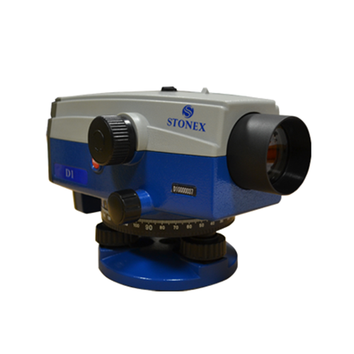
Auto / Digital Levels
STONEX D1 digital autolevel is the recommended leveling instrument for contractors, builders, professionals land surveyors and Engineers who demand accurate leveling every time. The accuracy of ± 1.5 mm on a base of 1 Km – double run – makes STONEX D1 the perfect equipment for the 3rd order leveling and for construction industry. Faster automatic measurements – difference in height and distance – are digitally determined: the fully electronic measurement results appear in the clearly visible display window after less than 2 seconds.
-
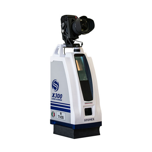
Install a DSLR camera to apply high resolution images to your scans
Calibrated camera adapter designed to obtain photorealistic scans and meshes. The adapter allow to install on X300 a Reflex camera and to control it automatically with the scanner, which will use it instead of the internal cameras.
-
High Precision Antennas for all field survey works
Stonex family of GNSS antennas is designed to enhance and support the performance of Stonex precise positioning receivers. The antennas receive GNSS multi-constellation signals. Each antenna is built to withstand various application and surveying needs.
The Stonex antennas can be used in land survey, marine survey, channel survey, seismic monitoring, bridge survey, container operation and agriculture applications.
They have high gain and wide beam width to ensure the signal receiving performance of satellite at low elevation angle. The phase center of these antennas remains constant as the azimuth and elevation angle of the satellites change. Signal reception is unaffected by the rotation of the antenna or satellite elevation, so placement and installation of the antenna can be completed with ease.
-
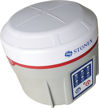
High Performance with Atlas® Capability
Stonex S10A is the latest Stonex GNSS receiver characterized by a new feature that enhance the performances and potential of the field surveys.
Thanks to aRTK function and service of Atlas® correction, Stonex S10A is able to work in particularly difficult areas.
Atlas® gives the precise positioning centimetres around the world and delivers world wide centimetre level correction data over L-band communication satellites and over internet.
S10A Receiver is equipped with all important connectivity capabilities, including Bluetooth and Wi-Fi modules, for a fast and stable connection to controller and PC. With radio and the internal GSM is possible to transmit and receive real-time corrections easily and fast.
You can measure the points quickly without the perfect verticality of the pole. The receiver can automatically record the positioning data when the electronic bubble detects the correct level, with no action required by the operator.