Shop

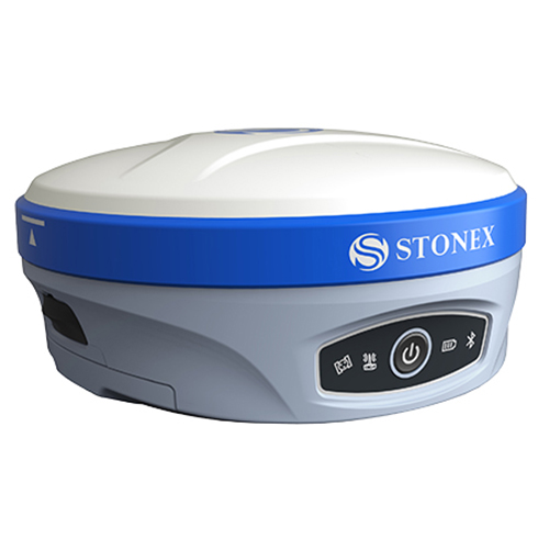
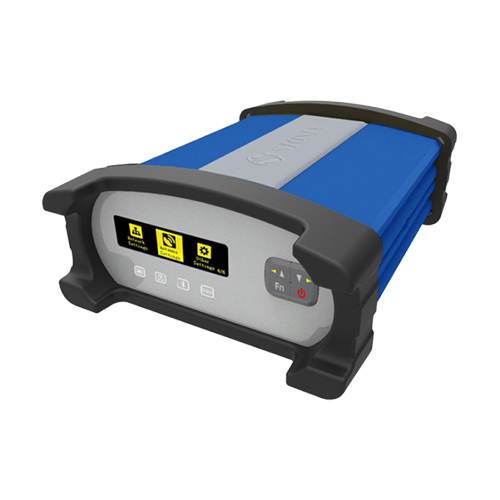
  • The New Generation GNSS Receiver

    Stonex S10, the most advanced integrated GNSS Receiver ever appeared on the geomatic scene, leads to a new generation of smart and open GPS, where the User has the ability to install customized applications directly on the receiver.
    The advanced features of Stonesx S10, such as automatic leveling with electronic bubble, make surveying much faster and accurate.
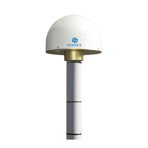
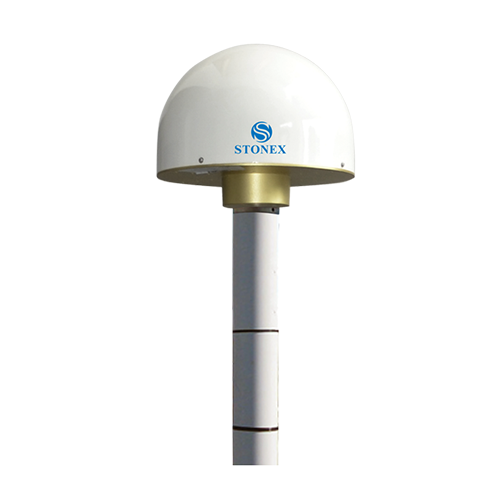
    The sophisticated internal structure design guarantees a compact housing: GNSS antenna, GPS board, power board, RX/TX radio, smart battery, 3.5G module, BT module and Wi-Fi module all take place in a well organized space, optimizing performances and power consumption.
    Stonex S10 is based on CORTEX-A8 platform with on board LINUX smart system combined with an excellent networking system. With the provision of a special SDK package it is possible to develop and install special applications that run inside S10 ecosystem, enabling an unlimited range of advanced applications.

  • Powerful Precision with Atlas® Capability

    Stonex S900A is equipped with an high performance GNSS board 600 channels and capable of supporting multiple satellite constellations: GPS, GLONASS, BEIDOU and GALILEO, including L-Band correction.
    Through the 4G GSM modem a fast internet connection is guaranteed for the reception of correction data and the management of the maps in the background.
    In the amazingly compact structure the Bluetooth and Wi-Fi modules allow always reliable data flow to the controller, and the integrated TX/RX UHF radiomodem with selectable frequencies, make S900A the perfect system for a GNSS Base + Rover.
    Stonex S900A integrates E-Bubble sensor that allows the measurement of difficult points with the pole not levelled. It is possible to measure points with an inclination of the pole up to 30° even in harsh environments and in the presence of magnetic fields.
    Thanks to measurement routine integrated into the field software, the management of tilt function is simple and intuitive.

  • Powerful Precision Performance

    S900 is the result of the continuous evolution of the Stonex GNSS integrated receivers.
    Featuring a new, high accuracy multi constellation antenna, a powerful UHF transmitter and the GSM 4G modem, for a fully integrated communications choice, combined with a light and modern design.
    Stonex S900 integrated GNSS receiver tracks all the present constellations and satellite signals GPS, GLONASS, BEIDOU, GALILEO and QZSS and through the upgradable firmware offers the opportunity to be day by day updated with the latest available features.
    On S900 it is possible to insert 2 smart hot swappable batteries at the same time, ensuring a maximum of 12 hours of operation without stopping.
    The power level can be checked and seen on the controller or directly on a led bar on the battery. Moreover, the same battery is used on S900 and on the Stonex controllers S4II C/H.

  • Powerful Precision & High Frequency

    S900T is the result of the continuous evolution of the Stonex GNSS integrated receivers.
    Featuring a new, high accuracy multi constellation antenna, a powerful UHF transmitter and the GSM 4G modem, for a fully integrated communications choice, combined with a light and modern design.
    Stonex S900T integrated GNSS receiver tracks all the present constellations and satellite signals GPS, GLONASS, BEIDOU, GALILEO and QZSS and through the upgradable firmware offers the opportunity to be day by day updated with the latest available features.
    On S900T it is possible to insert 2 smart hot swappable batteries at the same time, ensuring a maximum of 12 hours of operation without stopping.
    The power level can be checked and seen on the controller or directly on a led bar on the battery. Moreover, the same battery is used on S900T and on the Stonex controllers S4II C/H.

  • Powerful Precision with Atlas® Capability Stonex S900A-SE is a special edition of Stonex S900A. It is equipped with an high performance GNSS board 600 channels and capable of supporting multiple satellite constellations: GPS, GLONASS, BEIDOU and GALILEO, including L-Band correction. Atlas® is a subscription for S900A aimed to achieve 3 different levels of accuracy. Atlas® gives the precise positioning centimeters around the world, perfect when working in difficult areas. In the amazingly compact structure the Bluetooth module allow always reliable data flow to the controller. S900A is the perfect system for a GNSS Base + Rover. Stonex S900A integrates E-Bubble sensor that allows the measurement of difficult points with the pole not levelled. It is possible to measure points with an inclination of the pole up to 30° even in harsh environments and in the presence of magnetic fields. Thanks to measurement routine integrated into the field software, the management of tilt function is simple and intuitive.
  • Powerful Precision Performance

    S900-SE is the result of the continuous evolution of the Stonex GNSS integrated receivers.
    Featuring a new, high accuracy multi constellation antenna, a powerful UHF transmitter and the GSM 4G modem, for a fully integrated communications choice, combined with a light and modern design.
    Stonex S900-SE integrated GNSS receiver tracks all the present constellations and satellite signals GPS, GLONASS, BEIDOU, GALILEO and QZSS and through the upgradable firmware offers the opportunity to be day by day updated with the latest available features.
    On S900-SE it is possible to insert 2 smart hot swappable batteries at the same time, ensuring a maximum of 12 hours of operation without stopping.
    The power level can be checked and seen on the controller or directly on a led bar on the battery.

  • Beyond Imagination Stonex S800A is a compact, high-performance GNSS receiver with unique features and unmatched in its category. The S800A features the multi constellation 600 channels GNSS board and supports GPS, GLONASS, BEIDOU, GALILEO, including L-Band correction. The unique internal antenna combines GNSS, Bluetooth and Wi-Fi integrated modules to optimize space and increase performance. This technology provides stronger and cleaner signal monitoring, which means unprecedented results. Designed for all day use in surveying application, S800A includes several features: Linux Operating System, WEB UI interface, UHF radio modem, high battery capacity and IP67 certification. Stonex S800A GNSS receiver, thanks to aRTK function and service of Atlas® correction is an ideal solution for any surveying field work and in particular in difficult areas. Atlas® delivers world wide centimetre level correction data through L-band communication satellites and internet.
  • GNSS solution for your daily surveying job

    Equipped with an advanced 555 channels GNSS board and capable of supporting multiple satellite constellations, including GPS, GLONASS, BEIDOU and GALILEO, Stonex S800 GNSS receiver is an ideal solution for any surveying field work. The advanced receiver design gives S800 excellent signal tracking ability and interference resistant capacity.
    The independent R&D LINUX+CORTEX intelligent platform provides users high performance computing and infinitely expanding. The unique internal antenna combines GNSS, Bluetooth and Wi-Fi integrated modules to optimize space and increase performance.
    Advantages of portability and speed of operation make S800 GNSS receiver particularly suitable for fieldwork in areas of complex terrain. The Stonex S800 has built-in internal Bluethooth capability that allows the users to choose their data collector model and software.

  • GNSS handheld receiver for modern positioning technology

    GIS & SURVEY in one solution
    STONEX S7G GNSS receiver combine the modern positioning technology and versatility of a powerful handheld, perfect for collecting geographic data and operate fast and accurate measurements.
    S7G handheld is compact, ergonomic and small size and weight: 234 mm x 99 mm and 895g. S7G is powered by a Cortex-A8-AM33X 1GHz processor and Windows Mobile 6.5 Professional operating system. To increase performance and to load the job data is available an SD card slot for external memory (internal 32 GB is included). S7G integrate a GSM/GPRS modem that provides fast and efficient internet connection directly on the field, and Wi-Fi and Bluetooth technology, that allow the user to transfer data quickly and conveniently on long distances.
    Thanks to the 3G internal modem there is also the possibility to improve the accuracy of data, connecting to real time differential correction network provider.

  • 6.0” Android Rugged Tablet

    Rugged by nature, the UT series by UniStrong thrives in harsh operating environments.
    The UT10 is built to handle heavy work load over an extended period of time. It is designed to be drop resistant at heights of 1.5m with an IP68 protection rating and certified to MIL-STD.
    With Qualcomm Quickcharge 3.0 and Dual Sim card option, you can work all day and still remain contactable anytime, anywhere.

  • 8.0” Android Rugged Tablet

    Rugged by nature, the UT series by UniStrong thrives in harsh operating environments.
    The UT30 is built to handle heavy work load over an extended period of time. It is designed to be drop resistant at heights of 1.2m with an IP67 protection rating and certified to MIL-STD.
    With Qualcomm Quickcharge 3.0 and Sim card option, you can work all day and still remain contactable anytime, anywhere.

  • Rugged Handheld

    Rugged, reliable, highly productive
    STONEX S4II is the new entry in the Stonex rugged handheld family. Integrated devices, suitable for all the jobs where a rugged and high performances Windows Mobile PC is required. STONEX S4II can be used in any situation wherever the field staff goes.
    Complete product certifications and the advanced manufacturing process, ensure that the device is high efficient steady and durable, it can bring an unprecedented experience even for GIS users.

  • GNSS Receiver for GIS & RTK Applications

    Compared to traditional GIS products, the S500 is an intelligent, high precision data acquisition receiver that can be used without the need to hold it in your hand and therefore offers greater freedom of movement and flexibility.
    Thanks to the internal web interface, the receiver can be configured and prepared to receive RTK differential corrections and ready to be connected to any software for Survey or GIS.
    The S500 offers high-precision positioning and is equipped with a high speed 4G module. The positioning is so fast and reliable that it can also be used by vehicles moving at high speed. S500 works with all 4 satellite system (GPS, Glonass, BeiDou, Galileo), support access to external differential RTK signal to get centimeter level positioning results.
    Rubber protective cover, increase the protection of the device, non-slip and no damage, the whole device protective class reaches IP67, and it resists 1.2m hard ground drop.

  • Rugged Handheld

    STONEX systems are the hands-on answer to the needs to provide the professionals working on the field with integrated and scalable instruments, matching the most advanced GIS technologies existing on the market, significantly amplifying work opportunities.
    The S40 rugged and reliable design, combined with the IP67 Certification rating can withstand any harsh environment. STONEX S40 can be used in any situation wherever the field staff goes. S40 has on board the Android system for greater flexibility regarding applications that can be used and possibly developed specifically.
    Complete product certifications and the advanced manufacturing process, ensure that the device is high efficient steady and durable, it can bring an unprecedented experience even for GIS users.

  • 7” Rugged Tablet Windows

    Rugged by nature, the UT series by UniStrong thrives in harsh operating environments.
    The UT20 is built to handle heavy work load over an extended period of time. It is designed to be drop resistant at heights of 1.2m with an IP67 protection rating and certified to MIL-STD
    With Qualcomm Quickcharge 3.0 and Sim card option, you can work all day and still remain contactable anytime, anywhere.

  • High Precision Antennas for all field survey works

    Stonex family of GNSS antennas is designed to enhance and support the performance of Stonex precise positioning receivers. The antennas receive GNSS multi-constellation signals. Each antenna is built to withstand various application and surveying needs.
    The Stonex antennas can be used in land survey, marine survey, channel survey, seismic monitoring, bridge survey, container operation and agriculture applications.
    They have high gain and wide beam width to ensure the signal receiving performance of satellite at low elevation angle. The phase center of these antennas remains constant as the azimuth and elevation angle of the satellites change. Signal reception is unaffected by the rotation of the antenna or satellite elevation, so placement and installation of the antenna can be completed with ease.

  • GNSS Antenna for Reference Station
    2D Choke Ring Antenna


    HIGH PHASE CENTER STABILITY
    The unique 2D choke ring design of SA1500 ensures an excellent multipath reduction performance across all GNSS frequency bands including L-Band. It is ideal for applications of CORS stations, bridge and building deformation monitoring or geological monitoring due to its submillimeter phase center stability.


    TRACKING EVERYWHERE
    The strong ability to receive low elevation signals with high gain and wide beam width makes SA1500 an excellent choice for tracking visible satellites and provide stable and precision GNSS data under complex environments, such as obstructed environment of tree lines or construction.


    STRONG ANTI-INTERFERENCE PERFORMANCE
    The antenna LNA features an excellent out-of-band rejection performance, which can suppress the EMI, providing the stability and reliability of GNSS signals. Also it effectively avoids disconnection dangerous when receivers are being interfered by wireless communication systems, for example power grid, communication base station or radio modem applications.


    RUGGED
    The SA1500 cover is made of Glass Fiber Reinforced Polymer(GFRP) material and is structurally strong and reliable. The IP67 ruggedized cover is also designed for added protection for inside antenna avoid from dust and water.

  • GNSS Antenna for Reference Station
    3D Choke Ring Antenna

    HIGH PHASE CENTER STABILITY
    The unique 3D choke ring design of SA1800 ensures an excellent multipath reduction performance across all GNSS frequency bands including L-Band. It is ideal for applications of CORS stations, bridge and building deformation monitoring or geological monitoring due to its sub-millimeter phase center stability.

    TRACKING EVERYWHERE
    The strong ability to receive low elevation signals with high gain and wide beam width makes SA1800 an excellent choice for tracking visible satellites and provide stable and precision GNSS data under complex environments, such as obstructed environment of tree lines or construction.

    STRONG ANTI-INTERFERENCE PERFORMANCE
    The antenna LNA features an excellent out-of-band rejection performance, which can suppress the EMI, providing the stability and reliability of GNSS signals. Also it effectively avoids disconnection dangerous when receivers are being interfered by wireless communication systems, for example power grid, communication base station or radio modem applications.

    RUGGED
    The SA1800 cover is made of Glass Fiber Reinforced Polymer(GFRP) material and is structurally strong and reliable. The IP67 ruggedized cover is also designed for added protection for inside antenna avoid from dust and water.

  • GNSS Reference Station

    STONEX technology for GNSS reference stations and networks continues to evolve, meeting rapidly changing GNSS technology demands.
    STONEX C.O.R.S. stations (Continuously Operating Reference Station) are
    flexible and adaptable reference server that offer multiple solutions for multiple needs. STONEX C.O.R.S. stations meet the highest demands for reliability and work in the toughest environments.

  • 10.1” Full Rugged Tablet Rugged by nature, the UT series by UniStrong thrives in harsh operating environments. The UT50 is built to handle heavy work load over an extended period of time. It is designed to be drop resistant at heights of 1.2m with an IP68 protection rating and certified to MIL-STD. With 128GB SSD, 2x hot swappable batteries and wet hands/gloves operation, you can work all day without hassle and fear of losing data.
  • Simple, Tough, Accurate

    STONEX X300 is a 3D Scanner designed to deliver effective results every day, on any project. It’s ease of use, reliability, flexibility and reasonable price make it your perfect work companion.

  • Outstanding Volumetric Scanner for Field Use
    STONEX F6 is the market leader 3D handheld scanner for fast scanning of big objects and large areas from short to far ranges.
    Based on a patent algorithm of innovative encoding F6 provides superb quality of data making it the ultimate device for scanning complex scenes within seconds.
    The F6 is operated by Echo, an advanced and easy-to-use integrated software with high-end features such as:
    Advanced scanning modes with real time feedback
    Powerful 3D data editing tools
    Data quality for controlling distances and accuracies
    Advanced meshing with full color projection

  • A superb 3D volumetric handheld scanner for highly detailed scans of minimal size objects
    The F6 Short Range (SR) is designed especially for accurate and fast scanning of highly detailed small objects, positioned in close proximity. Based on a patented algorithm of innovative encoding, F6 SR provides excellent quality of data, making it the ultimate choice for rapid scanning.
    The F6 SR is operated by Echo, an advanced and easy-to-use integrated software with high-end features such as:
    • Advanced scanning modes with real time feedback
    • Powerful 3D data editing tools
    • Flexible integration to 3rd party software based on Mantis Vision DLL or SDK
    • Advanced meshing with full color projection
    • Composing registration of models from different scans
    • Multiple interfaces: tablet/laptop/VR
    • User interface: touch screen/ desktop

  • Laser scanners Accessories MONITORING KIT External Power Supply with Ethernet cable control. Kit designed for all kind of monitoring applications. GPS KIT Kit designed to connect the GNSS receiver to the X300 Laser Scanner. For outdoor use, the easiest way to georeference your 3D data.
  • X300 Framework for 90° tilted scanning (with Trolley Carrying Case)
    X300 Framework is a Stonex X300 Laser Scanner support accessory useful for scanning closed environments such as caves, architectural structures and tunnels, where ceilings are particularly high.
    This accessory allows the scanner to perform a full scan with a vertical field of view of 240° (the scan also covers the surrounding walls and part of the underlying surface).

    Thanks to X300 Framework it is possible now to shorten both time of work in the field and the time of post-processing, because the number of scans required is reduced.

  • Install a DSLR camera to apply high resolution images to your scans
    Calibrated camera adapter designed to obtain photorealistic scans and meshes.
    The adapter allow to install on X300 a Reflex camera and to control it automatically with the scanner, which will use it instead of the internal cameras.

  • HIGH QUALITY COLOR CAMERA ADD-ON FOR THE F6 FAMILY

    Enhances the scanner’s ability to capture color at the most realistic quality
    Mantis Vision’s five MegaPixel add-on color camera enhances the scanner’s ability to capture the highest color quality and the most realistic textured meshes, compared to any other handheld 3D scanner on the market today. The add-on’s high-resolution allows the scanners to quickly achieve 3D models that are suitable for integration into any AR/VR application. With the ability to connect to any F6 scanner in minutes, the add-on can be calibrated by the user via a simple and fast process, using a rapid workflow in-line with the other components of the F6 family.
    CAMERA BENEFITS:
    • High quality texture models
    • Photorealism and Hyperrealism textures
    • Generates bump mapping
    • Operates at 15 FPS
    • Connects multi synchronized units for a dynamic scanning
    • Compatible with gaming engines – Unity and Unreal

  • Powerful and usable 3D Software
    STONEX RECONSTRUCTOR SOFTWARE will guide you trough a complete and clear workflow with expandable modules suited to your needs.

  • The companion of every PROFESSIONAL SURVEYOR

    Stonex R1 Plus Total Station, precise distance and angles measurements, concentrated in 5 Kg of pure technology.
    The perfect tool whenever the topographic works requires a light and fast machine, all day working thanks to 26 hours of continuous operating time. The onboard field programs, included as standard, make R1 Plus suitable for any construction site, cadastral, mapping and staking out, works.
    No limitation for distance measurements, up to 5.000 m with a single prism – 600 m reflectorless (KGC 90%) – and 2” as angular accuracy, always guarantee a  reliable points calculation.
    R1Plus has been designed to hold out against rain and dust: the IP66 certification allows to go ahead with the survey even during hard rain. The body design is distinguished by its robust mechanical structure, and the high performance telescope, featuring 30X magnification and illuminated reticle, provide the best sighting quality in any lighting condition.

  • The companion of every PROFESSIONAL SURVEYOR

    Stonex R15 Total Station, precise distance and angles measurements, concentrated in 5 Kg of pure technology.
    The perfect tool whenever the topographic works requires a light and fast machine, all day working thanks to 24 hours of continuous operating time.
    The onboard field programs, included as standard, make R15 suitable for any construction site, cadastral, mapping and staking out, works.
    No limitation for distance measurements, up to 5000 m with a single prism 600 m reflectorless and 2” as angular accuracy, always guarantee a reliable points calculation.
    R15 has been designed to hold out against rain and dust: the IP55 certification allows to go ahead with the survey even during hard rain. The body design is distinguished by its robust mechanical structure, and the high performance telescope, featuring 30X magnification and illuminated reticle, provide the best sighting quality in any lighting condition.

  • High Precision TOTAL STATION.

    Now with Endless Friction Drives and Trigger Key
    High accuracy and long reflectorless range are the perfect combination that makes Stonex R2 Plus the best friend of every professional surveyor.
    Cadastral, mapping, staking out, and up to high precision monitoring works: within the range of R2 Plus Series, you will find the solution that fits your needs.
    R2 Plus comes standard with integrated onboard field software, a complete suite of applications, and an external controllers can be linked to STONEX R2 Plus, through the Bluetooth™ wireless connection: no limitation will stop your working process. Road software module is included as standard in each STONEX R2 Plus.
    Stonex R2 Plus model 2017 features endless friction drives for continuous horizontal and vertical rotations: no more knobs and clamps with limited movements but a more comfortable use of the station. The trigger key on the side of the instrument guarantees the same accuracy provided by a traditional clamp lock system.

  • High Precision TOTAL STATION.

    Now with Endless Friction Drives and Trigger Key
    High accuracy and long reflectorless range are the perfect combination that makes Stonex R25/R25LR the best friend of every professional surveyor.
    Cadastral, mapping, staking out, and up to high precision monitoring works: within the range of R25/R25LR Series, you will find the solution that fits your needs.
    R25/R25LR comes standard with integrated onboard field software, a complete suite of applications, and an external controllers can be linked to Stonex R25/R25LR, through the Bluetooth™ wireless connection: no limitation will stop your working process. Road software module is included as standard in each Stonex R25/R25LR.
    Stonex R25/R25LR features endless friction drives for continuous horizontal and vertical rotations: no more knobs and clamps with limited movements but a more comfortable use of the station. The trigger key on the side of the instrument allows you to start the measurement very easily.

  • High Precision TOTAL STATION.

    Now with Endless Friction Drives and Trigger Key
    Stonex R35/R35LR series is the most customizable Total Station of the market. Depending on the User needs, R35/R35LR comes with endless friction drives for continuous horizontal and vertical rotations, 2” accuracy and 600/1000 m reflectorless range.
    This advanced Total Station is fully customizable: each user can choose the software that best suits own needs. Several onboard software to be choosen, such as Microsurvey FieldGenius, Carlson SurvCE, ANTAS Mobile and many Custom field applications.
    In addition the TFT 320×240 touch screen display on both sides gives the Surveyor a clear, colourful and fully graphical environment, and the user friendly on board software supports the users with guided through functions for data collection, topographic surveys, staking out.
    The high-precision class 3 EDM featuring millimeter accuracy even on long range distances, and the absolute encoders performing high precision angles measurements, provide reliable points calculation in every condition.

  • DESCRIPTION

    Error free measurements improve the quality of your field works
    The fully automatic measuring ability and digital display excludes any reading errors and other possible human-made errors. Combined to the the increased productivity, up to 50% compared to the performances of a traditional optical level, with all leveling work carried out automatically, will greatly improve your professionality and profits.

    Fast, friendly, smart
    You’re only required to get the bubble within the black circle on the bubble vial, from there the STONEX D1 automatic compensator takes over and precisely levels itself. Just press the Easy one-touch operation key, and get instantly ΔH and HD, displayed on the LCD display. Using STONEX D1 as distance meter you can get measurements up to 80 m. STONEX D1 features the IP54 certification, it means safe works even in harsh weather conditions. The onboard adjustment program, height difference calculation, inverse staff measuring mode and error checking enable the user to execute the complete calculations set directly in the field.

  • DESCRIPTION

    To use together with a barcoded stadia for high precision measurements, the Digital Level D2 provides an height accuracy of 0,7mm/Km. This makes the D2 an ideal level not only for high order levelling but also deformation measurements and precise surveying, as well as general construction. The onboard adjustment program, height difference calculator, inverse staff measuring mode, in combination with various measuring configurations enable you to execute all calculation.

    Key Features:

    • The internal memory can store up to 2000 measures (points) that can be downloaded on a computer by an RS232 serial port
    • Easy to transport
    • Water and dust protected and allow long operation on field (about 16 hours).
    • The right solution for measure gradients or height precision GPS systems


  • DESCRIPTION The new, redesigned optic, is so bright that let you use the new STAL autolevels even in low-light conditions, thanks to the wide objective aperture (40 mm). STAL 1100 are available with 28X and 32X telescope, and give accuracy from 2mm/Km to 1.5 mm/Km. STAL 1000, with the same telescope magnifications, thanks to the high accuracy automatic air damping compensator,  features higher accuracy, up to 1.0 mm/Km on a double run leveling (STAL 1032). STAL 1100 offer minimum focusing down to 0.4 m for better performance in tight spots or on steep slopes. Key Features: A wide range of models, from 2 to 1mm/Km accuracy. The best value for money of the market Horizontal knobs with unlimited range; DEG and GON circle available Compact and light weight, water-resistant construction Magnetic-dampened automatic compensator Rugged design