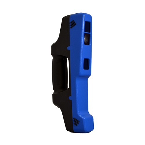
HIGH QUALITY COLOR CAMERA ADD-ON FOR THE F6 FAMILY
Enhances the scanner’s ability to capture color at the most realistic quality
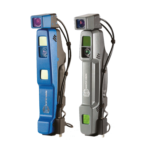
Mantis Vision’s five MegaPixel add-on color camera enhances the scanner’s ability to capture the highest color quality and the most realistic textured meshes, compared to any other handheld 3D scanner on the market today. The add-on’s high-resolution allows the scanners to quickly achieve 3D models that are suitable for integration into any AR/VR application. With the ability to connect to any F6 scanner in minutes, the add-on can be calibrated by the user via a simple and fast process, using a rapid workflow in-line with the other components of the F6 family.
CAMERA BENEFITS:
• High quality texture models
• Photorealism and Hyperrealism textures
• Generates bump mapping
• Operates at 15 FPS
• Connects multi synchronized units for a dynamic scanning
• Compatible with gaming engines – Unity and Unreal
-
-
A superb 3D volumetric handheld scanner for highly detailed scans of minimal size objects
The F6 Short Range (SR) is designed especially for accurate and fast scanning of highly detailed small objects, positioned in close proximity. Based on a patented algorithm of innovative encoding, F6 SR provides excellent quality of data, making it the ultimate choice for rapid scanning.
The F6 SR is operated by Echo, an advanced and easy-to-use integrated software with high-end features such as:
• Advanced scanning modes with real time feedback
• Powerful 3D data editing tools
• Flexible integration to 3rd party software based on Mantis Vision DLL or SDK
• Advanced meshing with full color projection
• Composing registration of models from different scans
• Multiple interfaces: tablet/laptop/VR
• User interface: touch screen/ desktop -
Windows Software
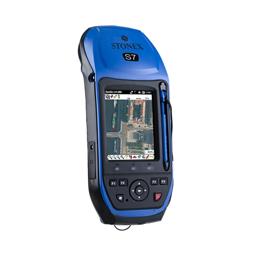
Stonex GeoGis is a powerful yet simple software solution for the collection of high quality feature and position data for GIS update and maintenance. GeoGis software provides simple and efficient workflows to capture high quality data quickly and easily. GeoGis is an option that can be embedded into handheld GIS systems. GeoGis is developed for Windows Mobile.
-
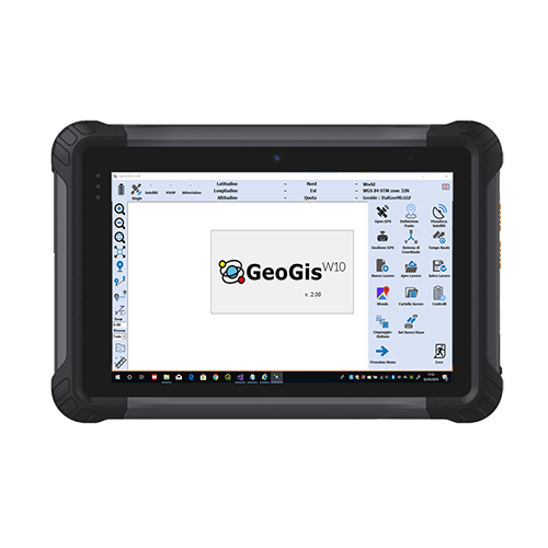
GIS Software for Windows 10 devices
GeoGisW10 is a software for topographic survey dedicated to GIS (Geographic Information Systems) applications.
The ideal operating environment is a Windows 10 Tablet with GPS, camera, modem for a data SIM and a Bluetooth system to allow connection to all Stonex GNSS receivers.
It allows topographic precision surveying using connection to networks that offer RTK service, or rapid survey with metric/decimal accuracy.
Creating a survey file now it is simple, that allows data post-processing for better accuracy.
For every survey, descriptive information may be associated with the elements detected according to a database structure created by the user and/or one or more photographs.
The application allows a fly-over on georeferenced raster images or downloaded by Google in real time.Topographic operations are summarized as:
- Topographic precision survey with RTK connection via SIM card or with the external GPS if this available
- Quick survey of metric/decimetric precision
- Survey of points, lines, areas and paths
- Stakeout of points detected or imported from files containing the coordinates
- Setting the most used reference systems and geoids in the world or localization in the field
- Tracking of graphically defined lines (bathymetry or similar operations)
Export / Import of data in the most used formats in topographic surveys/GIS (eg Shape file).GIS users are usually involved in data collection and applications but they are less familiar with methodologies and acronyms typical of GPS systems.This is why GeoGisW10 offers to the user very clear and simple menus and an arrangement of survey functions with intuitive terminologies.
-
Software for GNSS Network
GNSMART2 is the best solution for high accuracy real-time positioning without hardware restrictions.What is the GNSMART ?
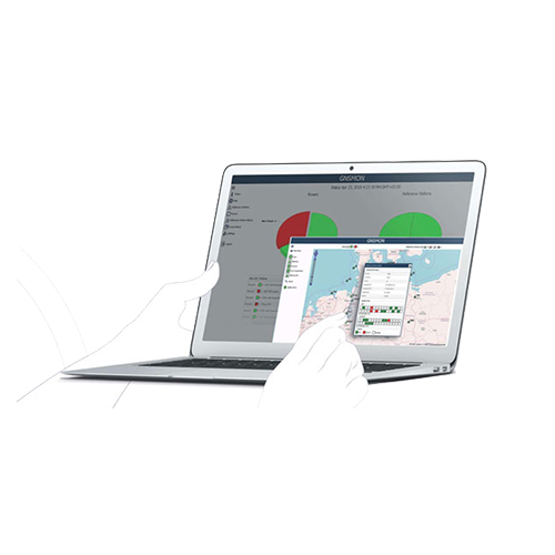
GNSMART2 (GNSS State Monitoring And Representation Technique) is a software that enables the consistent and seamless estimation of GNSS errors (rigorous solution) and provides both OSR and SSR corrections.
The data transmitted by GNSS technology allows high resolution observations but remains affected by many errors (satellite errors, orbit errors…). The GNSMART2 software allows to process these errors.
Software Features:- individual configurable and transparent software structure
- simplified and modernized visualization/interface for operators and users
- modernized operation and user management
- consistent and seamless estimation of GNSS errors (rigorous solution) supporting: all systems, all signals, any reference station, scalable networks, any rover providing various output formats
GNSMART2 supports:
more than 20 proprietary receiver interfaces (hardware independent).standardized input formats (RINEX, RTCM) and others (BINEX),heterogenous networks, international RTCM standard: RTCM3, FKP, Non-Physical Reference Stations, MAC, RTCM3-MSM
open formats: SSRZ, SAPA, Compact SSR, … -
High Precision Antennas for all field survey works
Stonex family of GNSS antennas is designed to enhance and support the performance of Stonex precise positioning receivers. The antennas receive GNSS multi-constellation signals. Each antenna is built to withstand various application and surveying needs.
The Stonex antennas can be used in land survey, marine survey, channel survey, seismic monitoring, bridge survey, container operation and agriculture applications.
They have high gain and wide beam width to ensure the signal receiving performance of satellite at low elevation angle. The phase center of these antennas remains constant as the azimuth and elevation angle of the satellites change. Signal reception is unaffected by the rotation of the antenna or satellite elevation, so placement and installation of the antenna can be completed with ease. -
High Precision Antennas for all field survey works
Stonex family of GNSS antennas is designed to enhance and support the performance of Stonex precise positioning receivers. The antennas receive GNSS multi-constellation signals. Each antenna is built to withstand various application and surveying needs.
The Stonex antennas can be used in land survey, marine survey, channel survey, seismic monitoring, bridge survey, container operation and agriculture applications.
They have high gain and wide beam width to ensure the signal receiving performance of satellite at low elevation angle. The phase center of these antennas remains constant as the azimuth and elevation angle of the satellites change. Signal reception is unaffected by the rotation of the antenna or satellite elevation, so placement and installation of the antenna can be completed with ease.
-
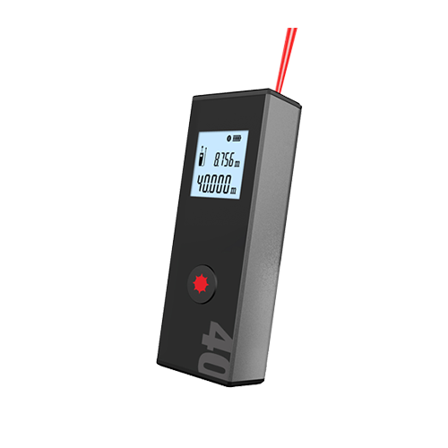
Handheld Laser distance meter easy to use
Stonex M1 is a small and very easy to use Bluetooth Laser Distance meter.
The aluminium alloy housing makes Stonex M1 resistant to the harshest jobsite condition. Thanks to the adaptive 1.4 inches B&W display readings during day and night become easy and friendly.
Never ending work with the long life lithium battery. M1 can communicate with Stonex Cube-a and other software with the built in Bluetooth module making the work more efficient and effective. -
RELIABILITY AND RUGGEDNESS
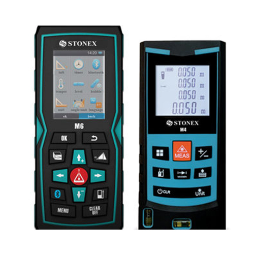
Stonex M4 & M6 are strongly protected against dust and splash water: M4 is IP54 certified while the IP65 grade of M6 guarantees a safe outdoor use of the unit, even under bad weather conditions.
UNIVERSAL END-PIECE
Stonex M4 & M6 are equipped with an universal flip-out end-piece that allows to measure in all possible conditions, even from edges or corners.
The ‘zero measurement point’ can be set in several modes (top/bottom/end-piece); moreover, on M6 the zero point can be set matching the position of the tripod, when in use.LI-ION BATTERY, BLUETOOTH®, ICONS DISPLAY…
… are just a short list of the advanced features of the new Stonex M6 Laser Distance meter: ask your local Stonex Dealer for a complete demonstration.
-
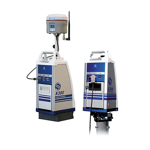
Laser scanners Accessories MONITORING KIT External Power Supply with Ethernet cable control. Kit designed for all kind of monitoring applications. GPS KIT Kit designed to connect the GNSS receiver to the X300 Laser Scanner. For outdoor use, the easiest way to georeference your 3D data.
-
Software Office Solutions
Entirely designed and developed by the Stonex R & D department, Ntrip-caster is the ideal software for GNSS NTRIP network management.DESCRIPTION
It’s perfect integration with the SC200 makes Ntrip-caster the essential tool for everyday’s work. Ntrip-caster gives the user an intuitive and powerful interface. It is an excellent server program to manage CORS stations in an autonomous and independent way; to transmit a single-base correction to multiple rover users, to manage them simultaneously and at any time in a reliable and efficient way.
Ntrip-caster offers the opportunity to the network administrator to monitor and limit users’ access in real time. Combining with SC200 CORS the software allows users to download data through FTP server, to create a new network or to strengthen an existing one. -
The companion of every PROFESSIONAL SURVEYOR
Stonex R1 Plus Total Station, precise distance and angles measurements, concentrated in 5 Kg of pure technology.
The perfect tool whenever the topographic works requires a light and fast machine, all day working thanks to 26 hours of continuous operating time. The onboard field programs, included as standard, make R1 Plus suitable for any construction site, cadastral, mapping and staking out, works.
No limitation for distance measurements, up to 5.000 m with a single prism – 600 m reflectorless (KGC 90%) – and 2” as angular accuracy, always guarantee a reliable points calculation.
R1Plus has been designed to hold out against rain and dust: the IP66 certification allows to go ahead with the survey even during hard rain. The body design is distinguished by its robust mechanical structure, and the high performance telescope, featuring 30X magnification and illuminated reticle, provide the best sighting quality in any lighting condition.